|
| |
[View / print / Save this letter as a PDF file.
(3.99MB)] [Download Adobe Reader
PDF file reader.]
18 July 2009 Click on the pictures to enlarge them.
Greetings again from New Mexico. We hope the first half of this year has been
good for you. Since last year, we have been looking forward to going back to
Ireland this June. It has been five years since we were there in 2004. During
last winter we were busy planning our itinerary and making reservations. We
decided to leave here on 1 June and return on 30 June.
A SAD INTERLUDE
While planning for the trip we received word that Robert’s oldest nephew, John
Abell, had contracted leukemia. He was 50 years old. His mother, Robert’s
sister, had come down with leukemia when she was 48 and died 4 years later. John
fought hard and endured weeks of chemotherapy, but he succumbed to an infection.
He is greatly missed.
FAMILY DOINGS
Early this year we were also busy learning Easter music with our choir Now
we have the summer off, but will start in September learning new Christmas music
for that big musical presentation.
Robert also keeps busy with American Institute of Aeronautics and Astronautics (AIAA)
activities. This year he became an Associate Fellow of the Institute. He is
Albuquerque section treasurer (his 19th year) and was also the speaker for the
50th anniversary celebration in February. He represented AIAA when he gave a
presentation on “Stars” to students at the Native American Community Academy and
a presentation on “The Solar System” to the Educational Retirees of Valencia
County.
This year Linda is serving as treasurer of our local, Chaparral, chapter of the
Family Motor Coach Association (FMCA). Chaparral treasurer’s records now look a
lot like the AIAA Albuquerque records.
OFF TO IRELAND
We left Albuquerque the afternoon of 1 June and arrived in Dublin about 9:00 AM
on 2 June. On this trip we wanted to have time to do some Malseed family
research, so we stayed 4 nights in Dublin and 5 nights in Belfast. In Dublin we
visited the National Library and the National Archives looking for references to
Malseeds. In Belfast we stayed at a B&B near the Public Records Office of
Northern Ireland and spent 3 days searching through old Presbyterian records
from churches in the area where Malseeds primarily lived. We came home with many
pages of notes to be absorbed later.
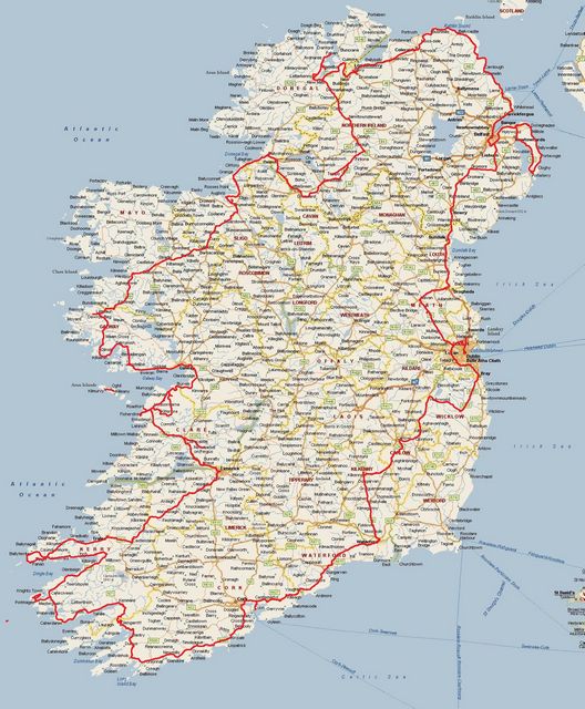
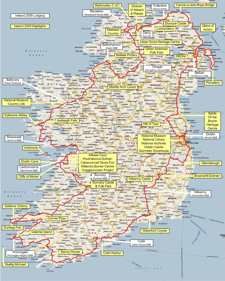
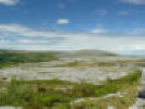
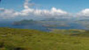
This map shows our 1,626 mile journey around Ireland. We started in Dublin
(middle of the east coast) and drove counterclockwise around the island and
finally departed from Dublin. Also included on the map is our Portaferry trip
with Jim Maultsaid.
 Our path around Ireland.
We stayed in Dublin at a Bed & Breakfast between the airport and town, and rode
the Dublin bus on a 5-day pass while we were there. In addition to doing
research we also saw several of the sights around Dublin such as Christ Church
Cathedral, Ha’penny Bridge, and Dublin Castle. We visited the National Museum
and the Guinness Storehouse.
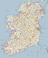
 Ha’penny Bridge over the River Liffey.
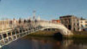
 Dublin Castle.
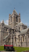 Christ Church Cathedral.
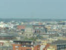 View from Guinness Storehouse.
On our way from Dublin to Belfast we stopped to see the Hill of Tara and the
Boyne Battlefield. However it was raining very hard and a very strong wind was
blowing, so we could not take any photos at either place.
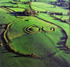 Hill of Tara.
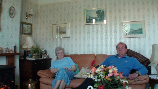
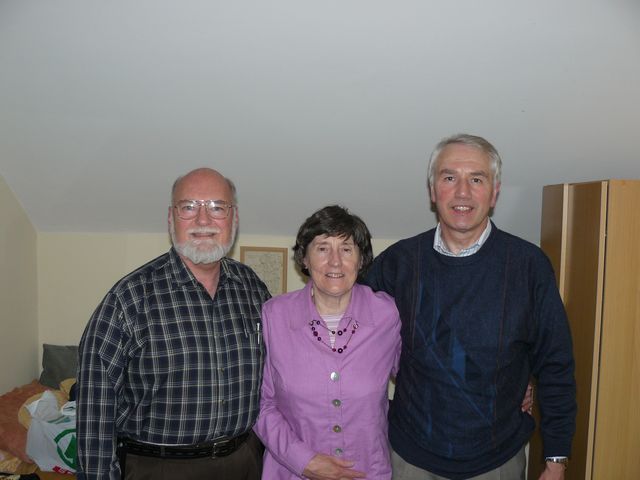
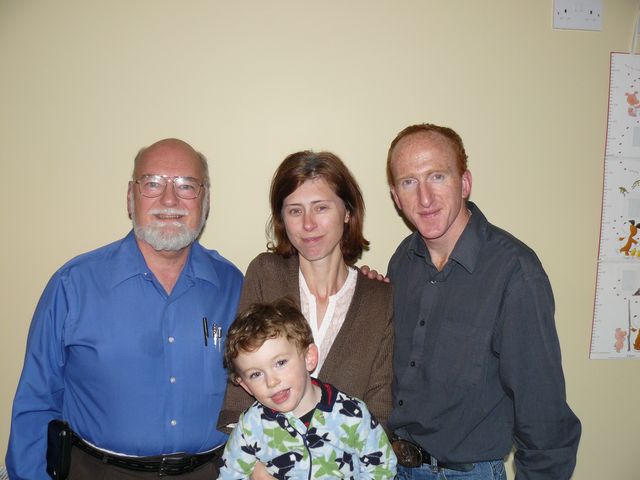
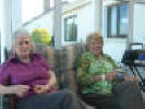
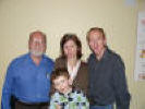
We visited with Jim Maultsaid and his mother in Bangor.
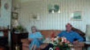 With Jim and his mom.
Jim took us on a trip to see Portaferry, a port city at the mouth of Strangford
Lough. Portaferry was the last port that Robert’s ancestor John Malseed saw when
he sailed from Ireland in 1821. The castle was there at the time, as was the
building in the next photo. John’s ship was there for repairs. He had left Derry
(Londonderry) earlier, but the ship leaked and needed repair.
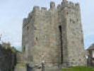 Portaferry Castle.
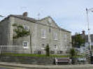 John Malseed would have seen this building.
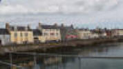 Portaferry.
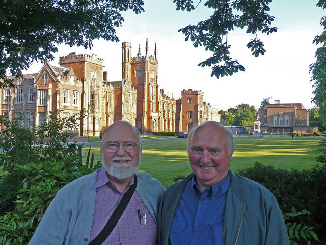
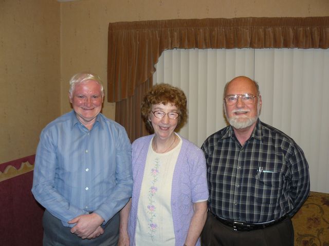
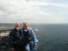
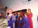
On our 30th wedding anniversary we met with cousin Eric Beatty who treated us to
dinner and gave us a tour of Belfast.
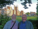 Robert and Eric at Queens University.
Eric is a retired professor from Queens University.
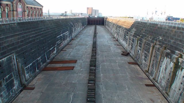
 The Titanic’s dry dock.
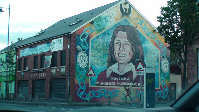
Many murals depict opposing political views.
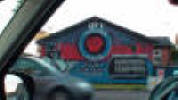 Ulster Freedom Fighters.
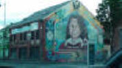 Sinn Féin headquarters.
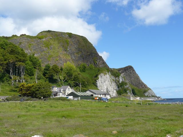
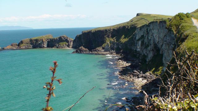
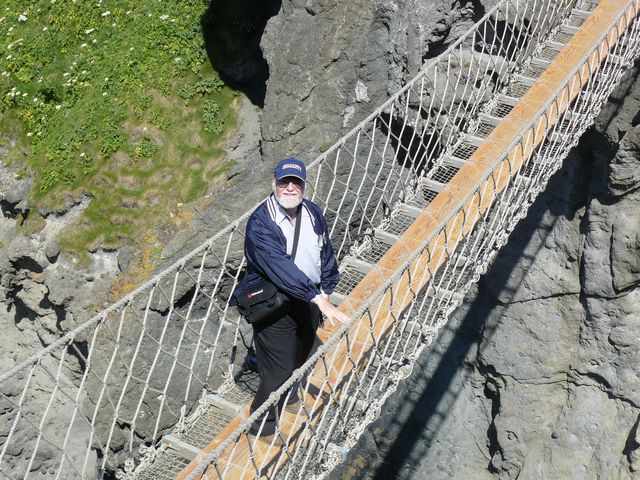
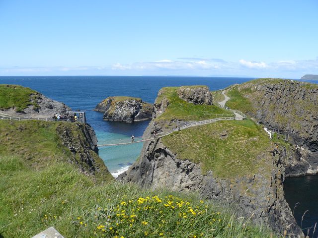
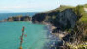
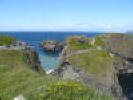
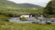
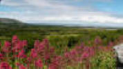
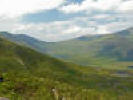
We drove along the beautiful coast of County Antrim as we went from Belfast to
Coleraine, and we stopped to see the Carrick-a-Rede rope bridge and the ruins of
Dunluce Castle.
 Antrim coast scene.
 Approaching the rope bridge.
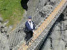 Robert on the bridge.
 Carrick-a-Rede rope bridge.
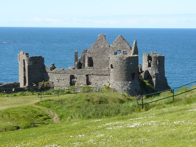
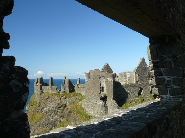
A little closer to Coleraine are the ruins of medieval Dunluce Castle. In 1639
the kitchen fell into the sea. The castle was finally abandoned after the Battle
of the Boyne in 1690 because the family had backed James II rather than William
of Orange.
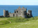 Dunluce Castle ruins.
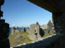 Inside Dunluce Castle ruins.
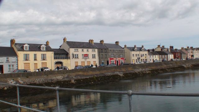
We spent a night in Coleraine as a guest of Marina Malseed Dallas.
 Cousins Nan and Marina greet us.
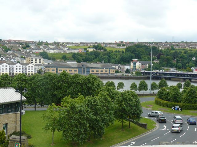
The next day we toured the city of Derry (Londonderry) where Robert’s ancestor,
John Malseed had sailed from in 1820. (After the ship was repaired and left
Portaferry early in 1821, it foundered at sea and all persons were rescued and
taken to Lisbon, Portugal. John eventually arrived in the USA on 12 Apr 1821.)
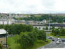 River Foyle in Derry where John Malseed embarked.
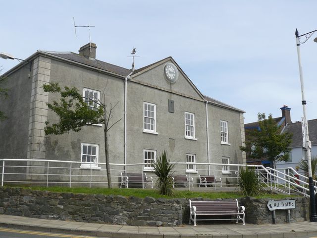
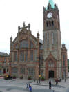 The Guildhall.
We walked around the old city walls of Derry and went to the Tower Museum, the
Harbor Museum, and the Guildhall. That night we stayed with Don and Nan Malseed
Hill. Before we left the next day, Nan showed us more of Derry and the
surrounding area. We also got a private tour of the new Ulster-Scots Heritage
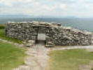
and Education Centre at Monreagh. Then we visited the stone fort shown below. It
is close to where the first Malseeds lived in 1614 when they went to Ireland
from Scotland to be a part of the Ulster Plantation.
 The Gianan of Aileach.
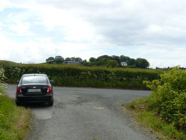
The first known Malseed in Ireland lived in Plaster township, so we drove
through this small farming area.
 Plaster township.
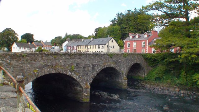
The next three nights were spent in Ramelton, more or less the heart of Malseed
country in centuries past. Nan and Marina’s parents, grandparents, and
great-grandparents are buried in Killydonnell Friary on the shore of Lough
Swilly.
 By the Malseed graves in Killydonnell Friary.
We also visited the Church of Ireland cemetery, the Bank cemetery on the other
side of the River Lennon, and Aghanunshin Abbey (closer to Letterkenny) to see
where other relatives were buried. We also looked for family information in the
Letterkenny library.
 River Lennon bridge in Ramelton.
 With cousins James and Dorothy Malseed, Ramelton.
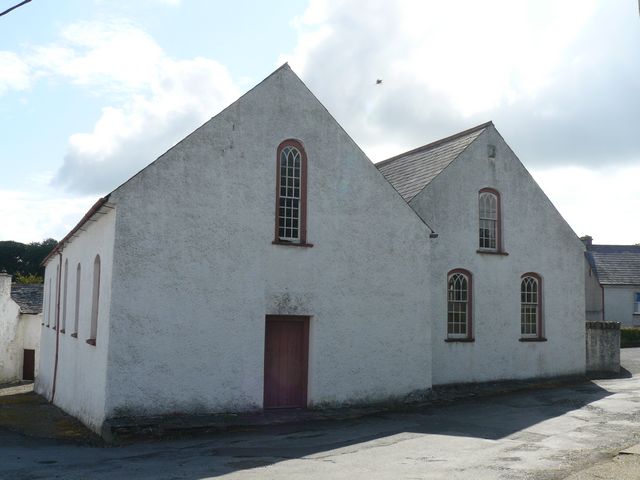
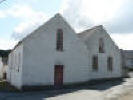 Old Presbyterian Meeting House, Ramelton.
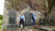
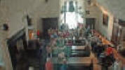
After worship service in Ramelton Presbyterian Church, we drove up to Rathmullan
to see the Malseed graves at St Columbs Church. We were fortunate in meeting the
retired church warden who gave us a tour inside the building. We wanted to stay
longer in Rathmullan, but a heavy rainstorm drove us back to Ramelton where we
met with James and Dorothy Malseed.
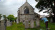 Photographing old Malseed graves in Rathmullan.
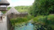
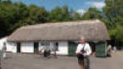
Our next stop was the Ulster-American Folk Park near Omagh. It is a large park
depicting life in Ireland and also life in the US for the Irish immigrants. We
checked at the Centre for Migration Studies at the park, but found very little
Malseed information.
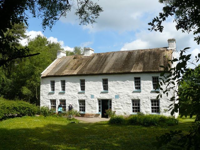
 Home at Ulster-American Folk Park, Omagh.
 With cousins Eric and Winifred Orr near Omagh.
Next we visited Marble Arch Caves and the Belleek pottery factory. We had
purchased some Belleek pottery five years ago, and now some more is on its way.
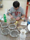 Making Belleek pottery.
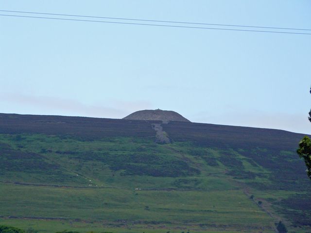
Heading down the west coast we passed Sligo near Queen Maeve’s grave.
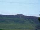 Queen Maeve’s grave near Sligo.
We toured the National Museum of Country Life at Turlough and met up with Robert
Malseed of Ballyvary.
 Round tower near Turlough.
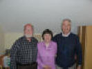
We spent that night with him, Michelle, and Conor.
 With Robert, Michelle, & Conor Malseed of Ballyvary.
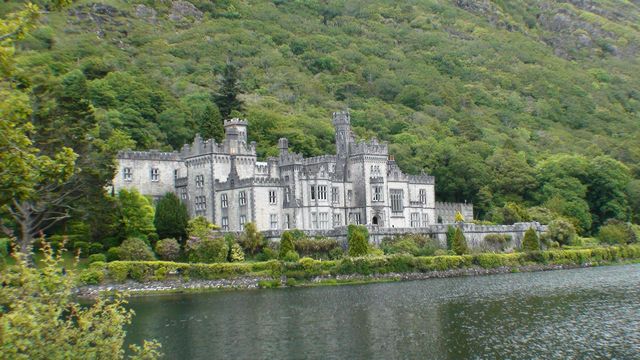
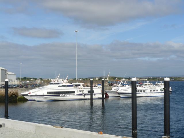
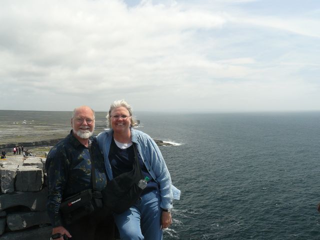
Our next goal was to stay on the north shore of Galway Bay and take a tour of
Inishmore Island in the bay. On the way we passed Aasleagh Falls and then took a
tour of Kylemore Abbey.
 Aasleagh Falls.
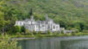 Kylemore Abbey.
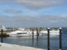 Ferries to Inishmore.
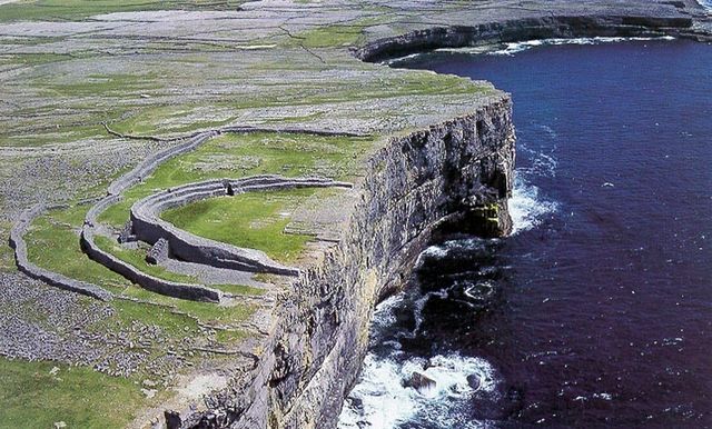
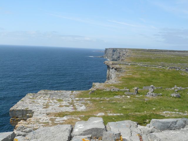
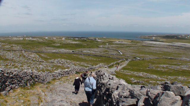
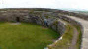
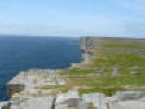
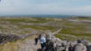
Inishmore is one of the Aran Islands. It is a popular destination, with its bare
limestone fields, stone walls, sheer cliffs, and Dun Aonghasa fort which is
backed up to a high cliff.
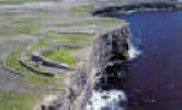 Dun Aonghasa fort on Inishmore Island from the air.
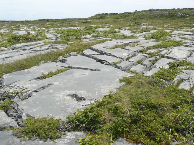
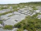 Limestone covers Inishmore Island.
Residents used seaweed to make soil for farming.
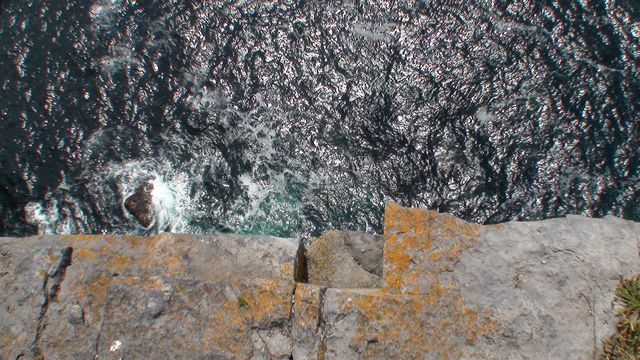
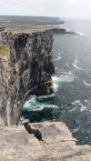 Cliffs at Dun Aonghasa fort.
Attack from the sea was not likely.
 A long way down.
 Cliffs at Dun Aonghasa fort.
 On the edge.
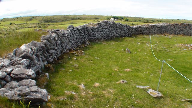
 Stone fences as far as you can see.
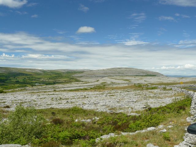
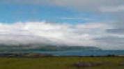 Clouds cover the Burren by Galway Bay.
The limestone landscape of the Aran Islands continues on the south side of
Galway Bay where it forms an elevated area called the Burren. We wanted to
explore more of this region, so we spent three nights at Lisdoonvarna.
Limestone usually has many caves, and we toured two in the region, Aillwee Cave
and Doolin Cave that features a huge stalactite.
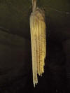 Doolin stalactite.
The Burren covers much of county Clare and is
home to many stone forts, and megalithic structures such as the dolmen, ancient
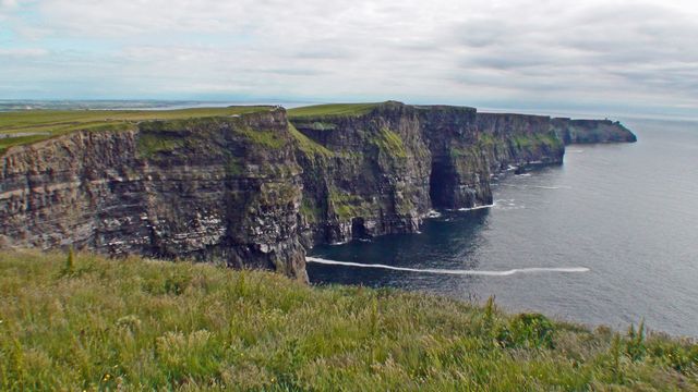
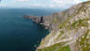
passage tombs. A portion of the coast of Clare is formed of high cliffs. We had
visited the Cliffs of Moher five years ago, but we now wanted to see them in
afternoon lighting, and, if possible to see them from the ocean.
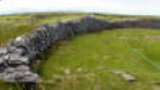 Caherconnell stone fort.
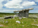 Poulnabrone Dolmen, an ancient portal tomb.
 View of the Burren near Aillwee Cave.
 View from Aillwee Cave toward Galway Bay.
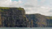
Our desire to see the cliffs was fulfilled on days of good weather. There is
also a new Visitor Centre at the cliffs which we enjoyed. One of the exhibits
gives you the feeling of flying off the cliffs with one of the sea birds. We
probably looked funny trying to keep our balance as we stood in front of the
wrap-around screen showing us a careening view from a bird’s perspective.
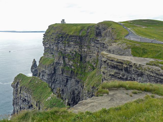
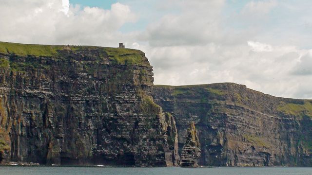
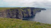 The Cliffs of Moher.
 Cliffs of Moher.
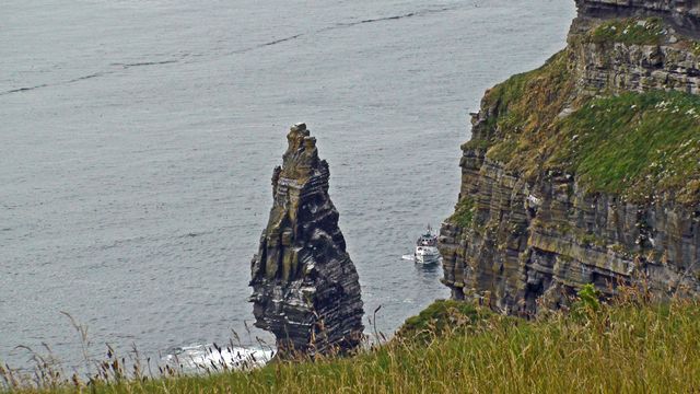
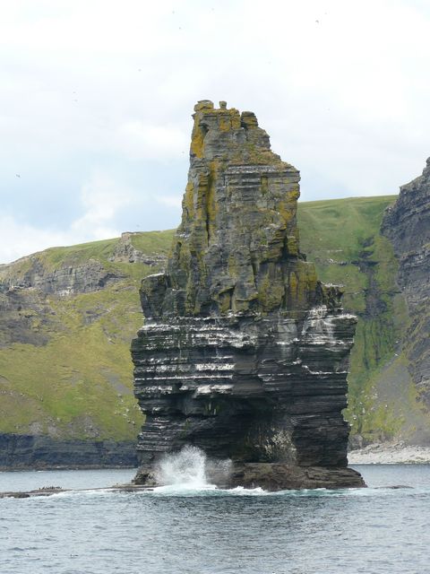
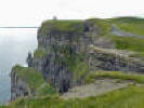
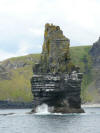
Now note the boat approaching the sea stack as we would do the next day.
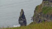 Cliffs of Moher and sea stack with tour boat.
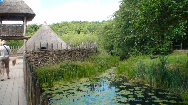
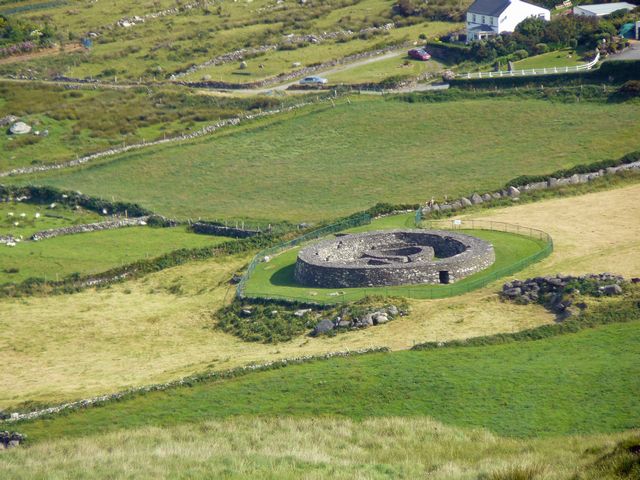
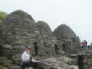
The Craggaunowen project is a park depicting life in Ireland through the ages.
The castle depicts high society in Medieval times.
 Craggaunowen Castle.
On the other hand, the crannog (an artificial
island in a lake), is where many people lived in much earlier times.
Craggaunowen also has a stone fort as it would have looked long ago. There are
many other exhibits as well.
 Crannog at Craggaunowen.
We sailed out of Doolin harbor to see the Cliffs of Moher from the Atlantic.
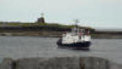 Boat to Cliffs of Moher.
It was also interesting to see how many sea birds lived on the sea stack just
offshore of the cliffs.
 Cliffs of Moher.
 Moher sea stack seen from the boat.
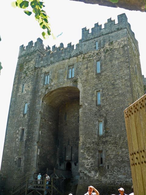
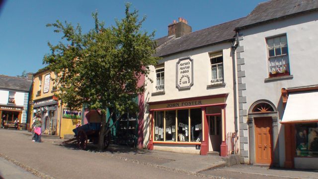
Bunratty, just outside of Limerick was our next destination. The castle is a
popular attraction, and it also has a Folk Park depicting life in Ireland in
times past.
 Bunratty Castle.
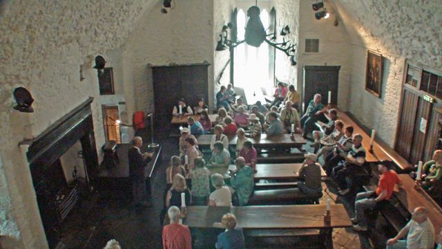
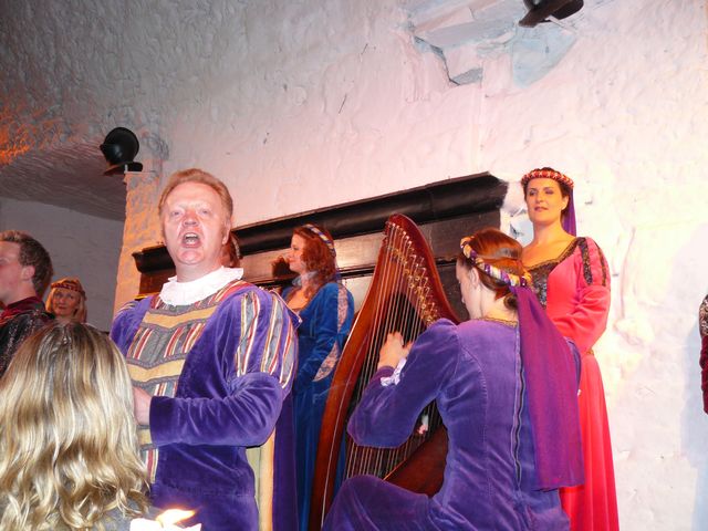
We toured the castle and park during the
afternoon and in the evening returned to the castle to partake of the popular
Medieval Banquet. The banquet was a lot of fun, in addition to serving delicious
food. We only had a knife and fingers to eat with. The attendants are also
talented musicians who put on a show before, during, and after the meal.
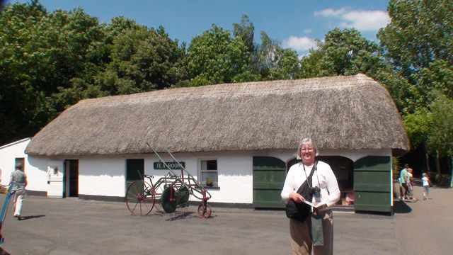
There are many buildings in the park – a variety of houses, stores, school,
church, mills, etc. A good sampling of Irish life. It is similar to the
Ulster-American Folk Park but without the American segment.
 Bunratty Folk Park.
 Bunratty Folk Park.
 Bunratty Folk Park – Studdert home.
 Bunratty Castle banquet hall.
 Bunratty Medieval Banquet entertainment.
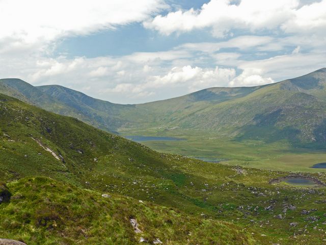
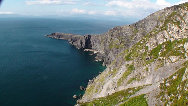
We then drove to County Kerry with a detour around the Dingle Peninsula. The
drive over Conner Pass is beautiful and interesting. The views are great and the
road is narrow on the northern side of the pass.
 View near Connor Pass on the Dingle Peninsula.
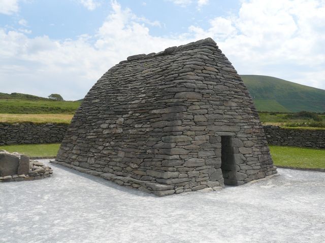
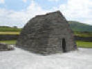 The Gallarus Oratory.
This oratory on the Dingle peninsula was built in the 7th to 8th centuries and
is the best preserved early Christian church (or chapel) in Ireland.
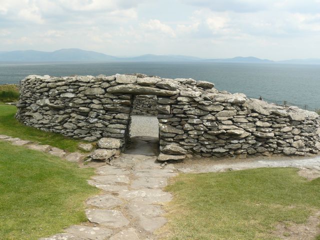
 Dunbeg promontory stone fort on Dingle.
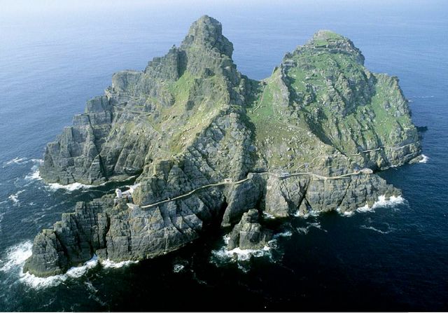
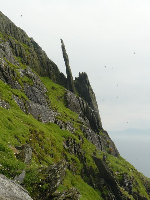
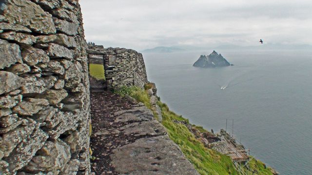
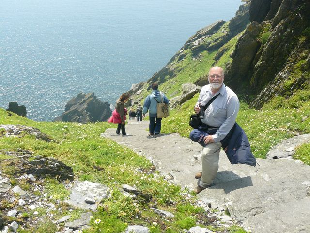
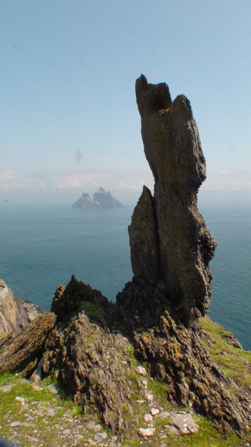
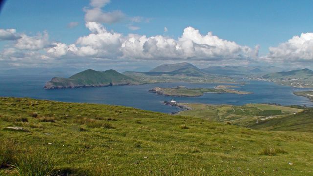
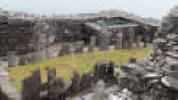
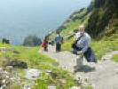
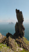
A highpoint of our trip, literally and figuratively, was our visit to the
Skellig Islands 8 miles off the coast of County Kerry. Little Skellig is home to
a colony of 20,000+ Gannets and other birds. Skellig Michael is home to a colony
of Puffins, but is best known for the fact that about 1,400 years ago a small
group of monks established a monastery there. It is 600 feet up on the
right-hand peak in this aerial view.
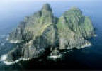 Skellig Michael.
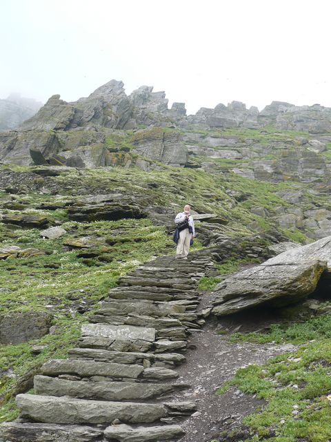
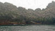
The obvious pathway around the island is to the modern lighthouses. The monks’
staircase winds steeply 600 feet up the peak on the right. We knew it would be a
real challenge for us to climb, but we did it.
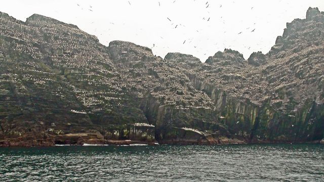
 The white area is a Gannet colony on Little Skellig.
Our boat took us close up to Little Skellig before going over to Skellig
Michael.
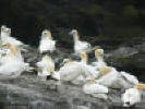 Gannets on Little Skellig - close up.
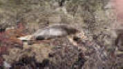 Young seal on Little Skellig.
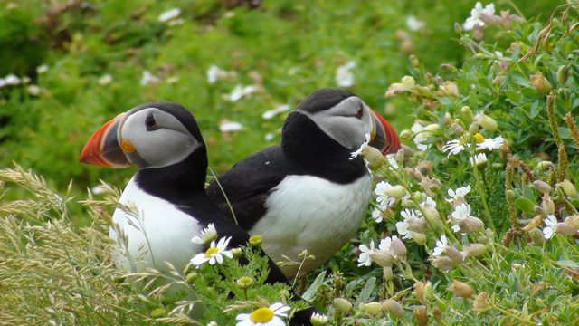
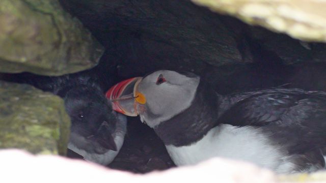
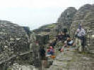
We went ashore on Skellig Michael and were greeted by thousands of Puffins.
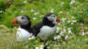 Puffins on Skellig Michael.
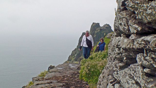
Now the chore was to climb up to the monastery and back down in the 2 ½ hours
allotted.
 Robert begins the climb.
The previous month a visitor from America died when he went off the path and
then fell.
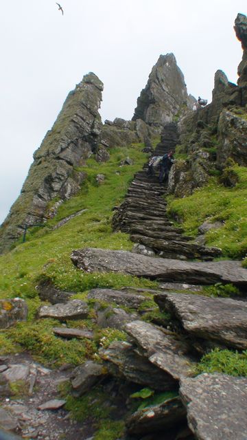
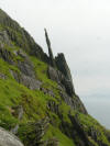 The steep slopes of Skellig Michael.
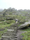
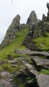 Last long group of steps up from the saddle.
Little Skellig, which looked so large from the boat now looked so small and
below us.
The monks had no OSHA (safety) rules to worry about.
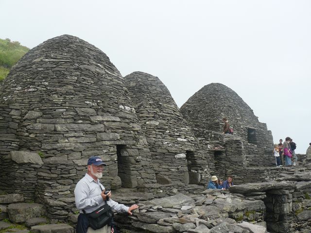
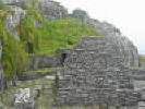
 Finally ready to enter the monastery.
 Linda arrives at the top.
We ate our lunch at this level before entering the monastery grounds.
 Robert in front of the monks’ cells.
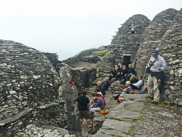
This is a UNESCO World Heritage Site.
 Cells to the right and large oratory to the left.
 The small oratory (chapel).
 The graveyard.
We had sufficient time at the top to rest, explore, and listen to an
archaeologist talk about the site.
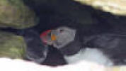 Mother puffin preens her baby in the nest.
 Time to go back down.
 Little Skellig in the distance.
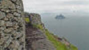
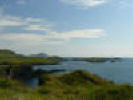
When we returned to Portmagee on the mainland, we headed to the Bridge Bar where
we could get a glass full of ice (a rare treat in Ireland) and some diet Coke.
It was very welcome after our trek on Skellig Michael. Also welcome were the
restrooms as there are no facilities on the Skelligs. After being refreshed, we
drove over the bridge to Valentia Island. The island was the site of the
European end of the first several transatlantic telegraph cables. There is also
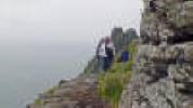
a small mountain on the island with great views all around. Cliffs on the north
side face the Dingle Peninsula and the Blasket Islands.
 Transatlantic cable site on Valentia Island.
 Valentia Island cliffs.
 Valentia Island view east.
Valentia island is also the site of a prehistoric fossil trackway of a large
four-footed amphibian. The foot tracks are about 12 inches apart.
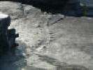 Tetrapod trackway.
Our journey continued the next day around part of the Ring of Kerry.
 Stone fort on Ring of Kerry.
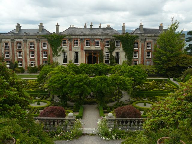
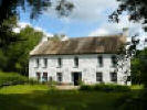
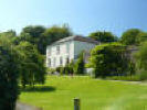
We stopped on our way to Cobh to visit Bantry House and gardens.
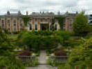 Bantry House and gardens.
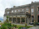 Bantry House.
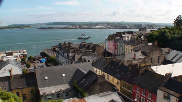
Cobh (pronounced “Cove”) is adjacent to Cork, and used to be a major port known
as Queenstown. In fact it was the Titanic’s final port of call before attempting
to cross the Atlantic. The Cathedral overlooks the harbor area.
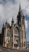 Cobh Cathedral.
The walk down and back up the hillside of Cobh
was hard on our legs still sore from our Skellig Michael trip.
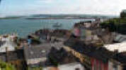 Cobh (previously Queenstown) harbor.
From Cobh we drove to Waterford. The crystal factory there is now closed, but
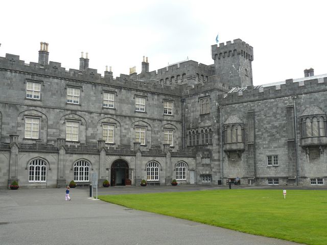
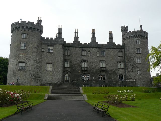
the visitor centre is still open. Then we went to Kilkenny and toured the
castle.
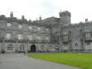 Kilkenny Castle.
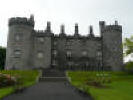 Kilkenny Castle.
Kilkenny was our last stop before returning to Dublin. The drive to Dublin was
not too far. We stopped near Carlow to see Brownshill Dolmen. It is a portal
tomb built about 3,000 to 4,000 BC. The capstone weighs about 100 metric tons.
How was the tomb built?
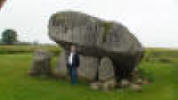 Brownshill Dolmen.
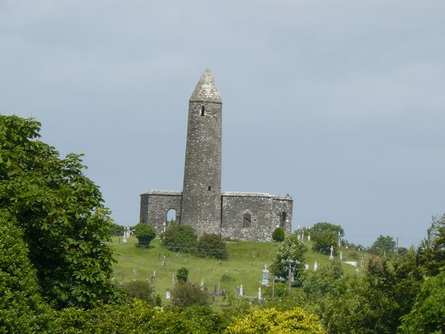
We then drove through the Wicklow mountains and stopped at Glendalough just east
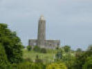
of Wicklow Gap. Glendalough is a monastic settlement founded in the 6th century
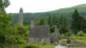 St Kevin’s church at Glendalough.
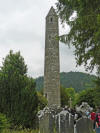 Round tower at Glendalough.
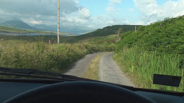
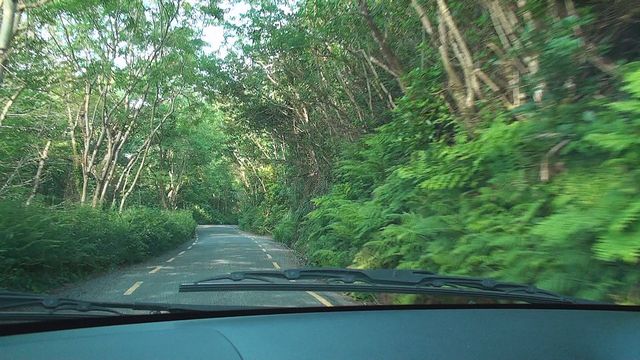
We spent 28 nights in Ireland and Robert drove 1,626 miles on the left side of
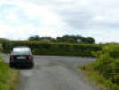
the road. Some of the roads are quite amazing. This is a 2-way road. You have to
go slowly and then figure out what to do when meeting a vehicle coming the other
way.
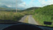
Fortunately here there is a turnout.
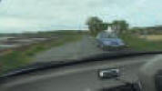
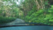
Another road not so narrow.
THE BOTTOM LINE
We continue to be thankful for the Lord’s provision for us. We trust in Him, and
pray that you will do likewise and enjoy a wonderful summer of 2009.
Today, 18 July, is Derry’s 3rd birthday.
Love,
Robert & Linda
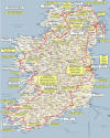 Map of our path, Lodging, and Highlights of Ireland.
Return to top of page.
|